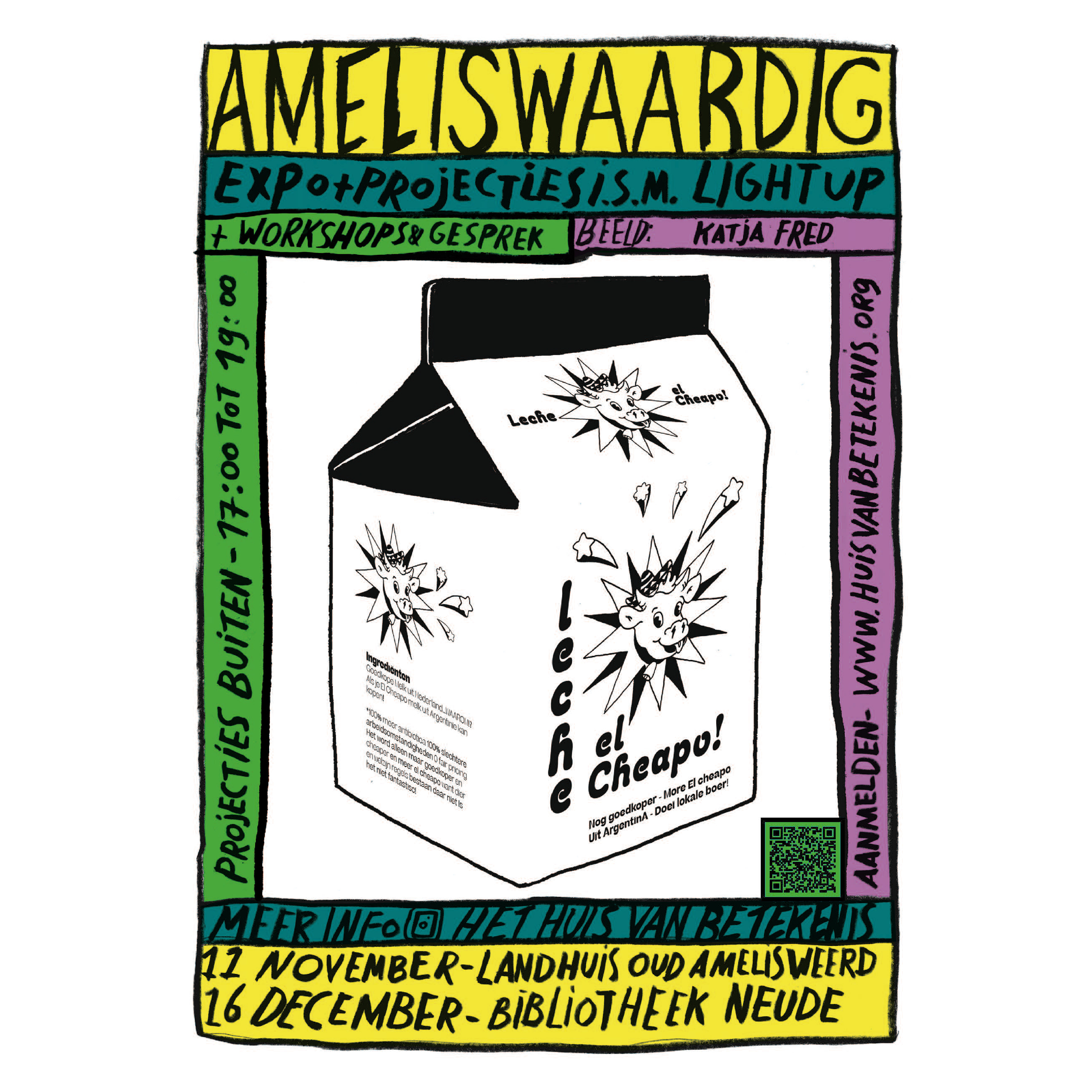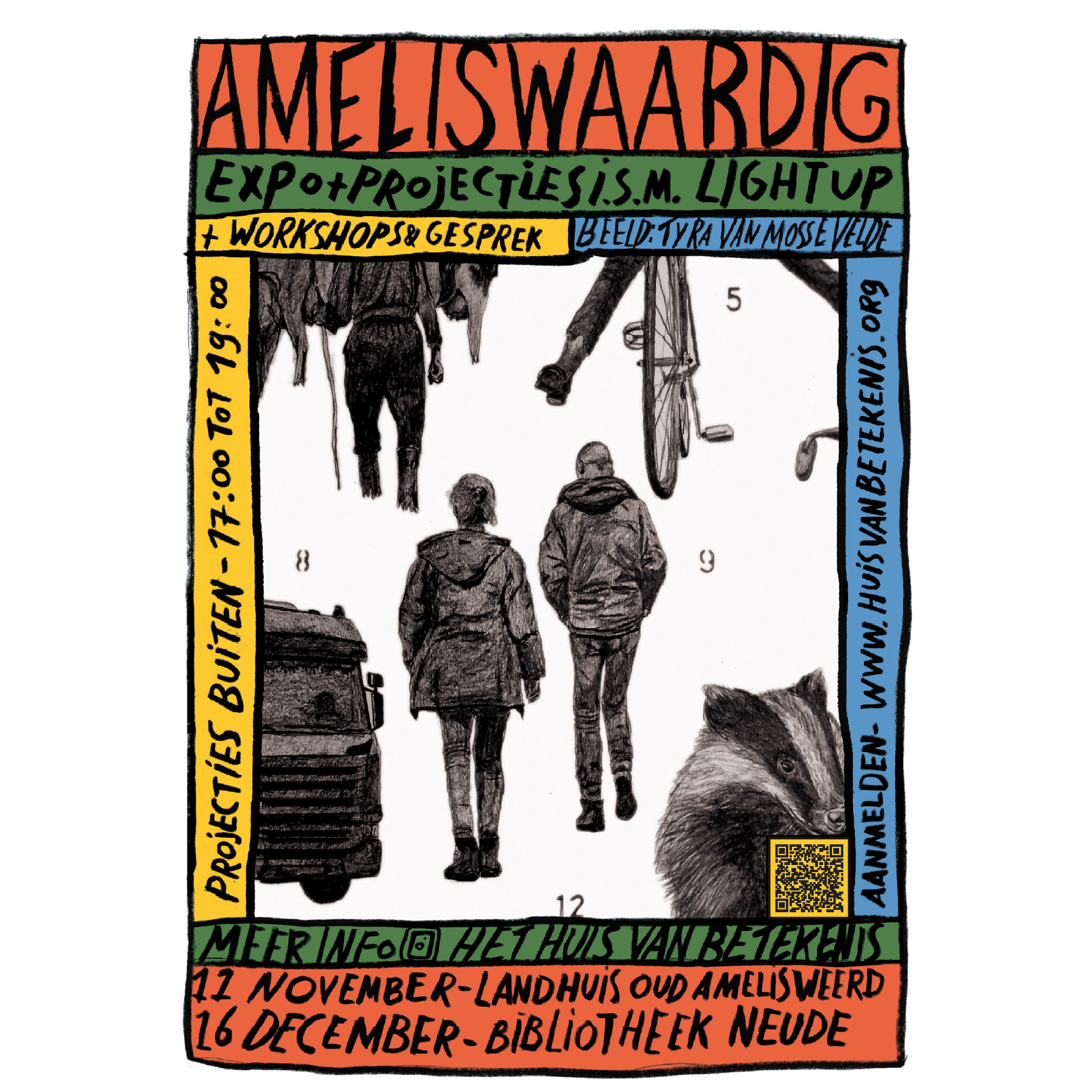
Ameliswaardig (Amelisweerd worthy)
These drawings and light projections are part of the project 'Ameliswaardig' (Amelisweerd worthy) by Het Huis van Betekenis. Read more about the project or watch our animation. Read more about my contribution below.
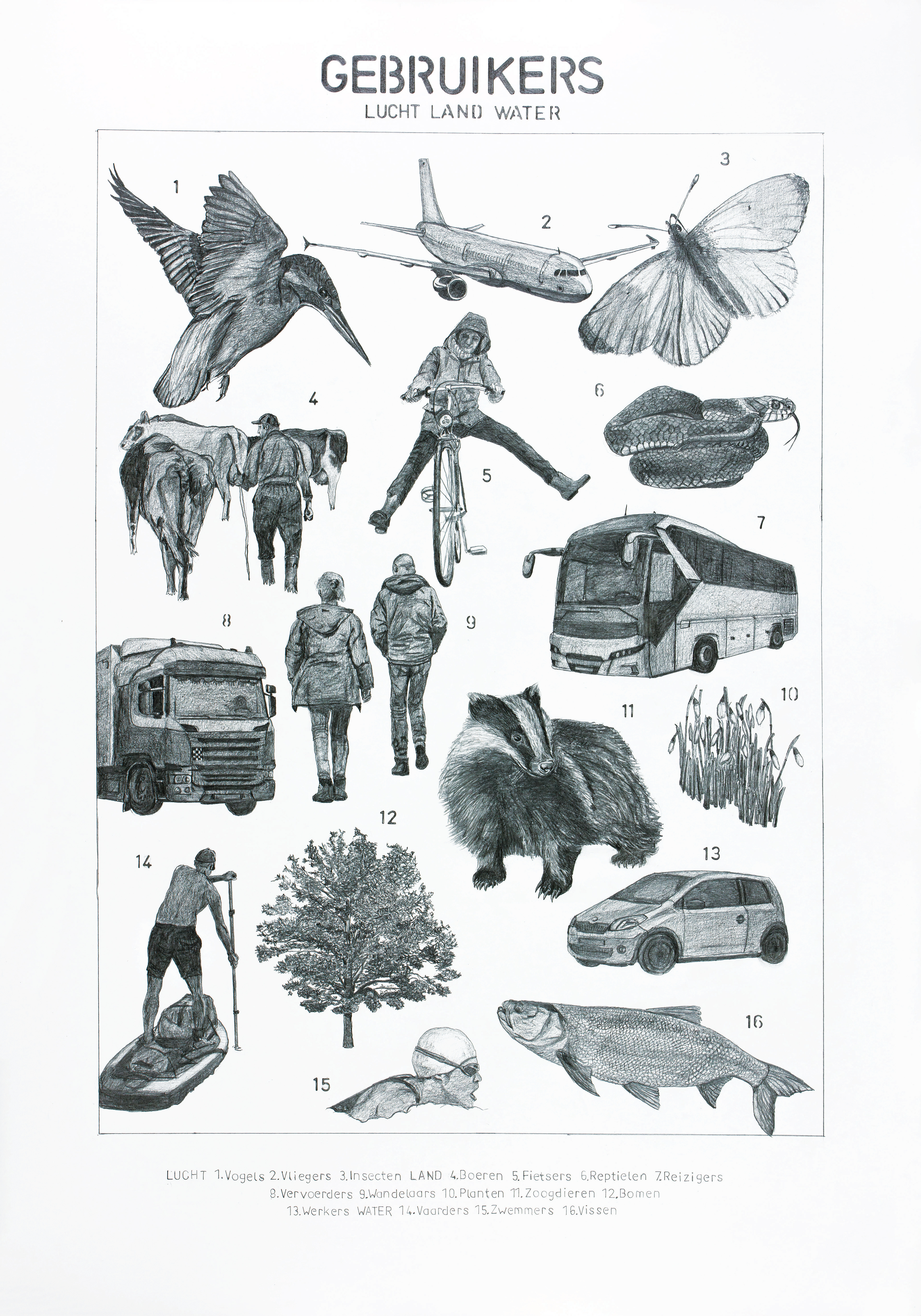
Road Users of Amelisweerd
Amelisweerd is a small parkland in the heart of the Netherlands that has long been a subject of debate due to the highway running next to it. In the past, the expansion of this highway sparked intense debates, and in 2024, a new proposal for expansion has returned to the political agenda.
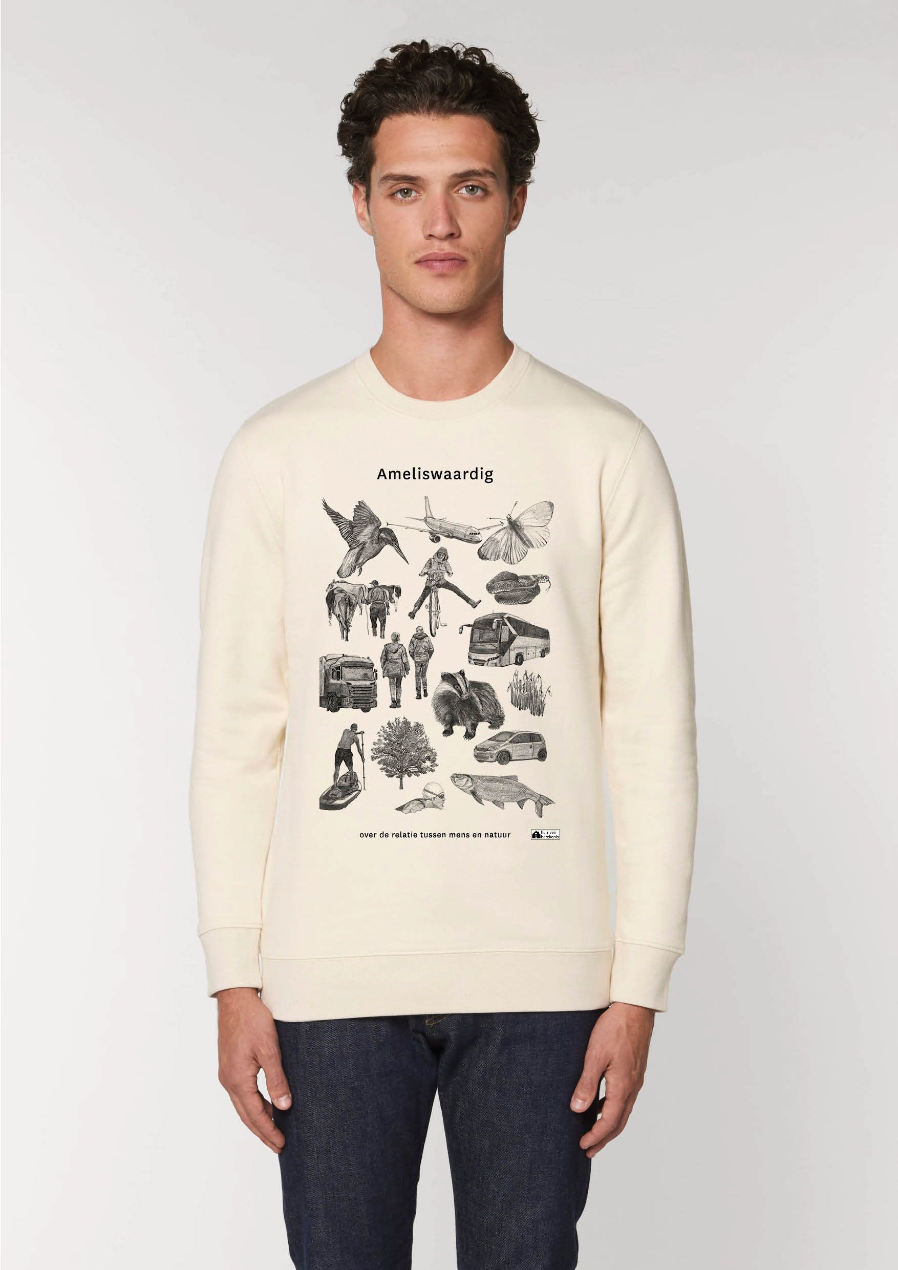
Commissioned by the 'Huis van Betekenis' (House of Meaning), five illustrators explored the relationship between humans and nature in Amelisweerd through the project ‘Ameliswaardig’ (Amelisweerd worthy). Each illustrator was assigned a specific theme: the forest, the farmers, history, politics, and road users. My theme focused on road users.
Road users are not just people traveling on asphalt. What moves above and below the ground, in the water, and through the air above? And how do these users relate to one another? The animals, plants, people, and vehicles depicted in my 'species map' represent the diverse users of the area. The conclusion is clear: we share this environment together, each with our own interests, and we must work collaboratively to find solutions.
In addition to the species map, I created data visualizations based on data and interviews with Rijkswaterstaat (Dutch Directorate-General for Public Works and Water Management), Transport and Logistics Netherlands, activists, and Statistics Netherlands (CBS). In total, I drew 3 interviews and 6 data visualisations. Apart from visualising the data I also wanted to show that humans and nature are interconnected.
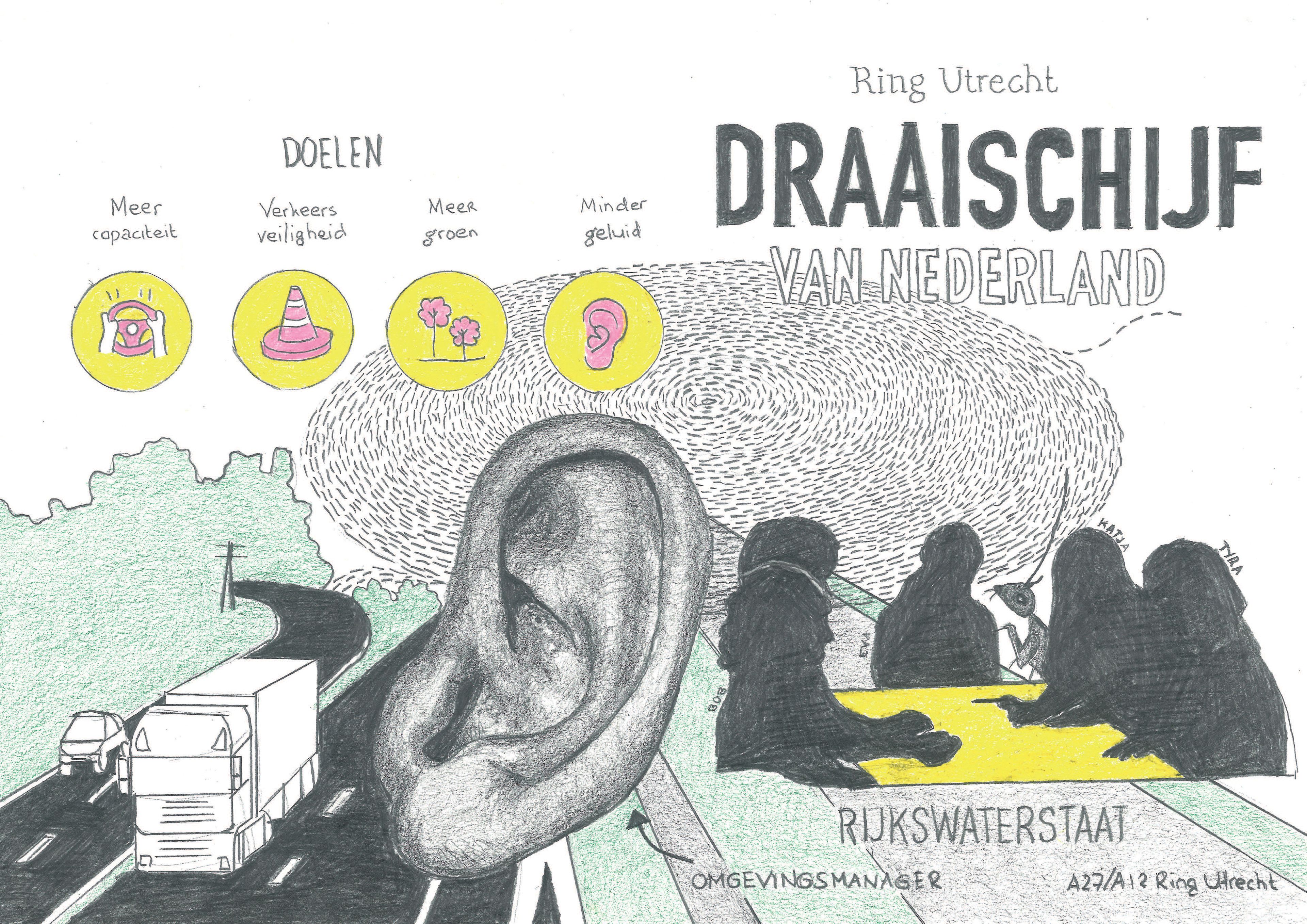

Draaischijf van Nederland
The Hub of the Netherlands
In an interview with a community manager from Rijkswaterstaat, the advantages of expanding the highway were discussed: increased capacity, improved safety, more green spaces, and less noise. The community manager’s role is to listen to the various voices in society.
National Highways in the Netherlands: The highway at Amelisweerd is considered the hub of the Netherlands, essential for maintaining traffic flow. The highest density of vehicles is found around Utrecht. The bustling traffic can be compared to an ant colony.
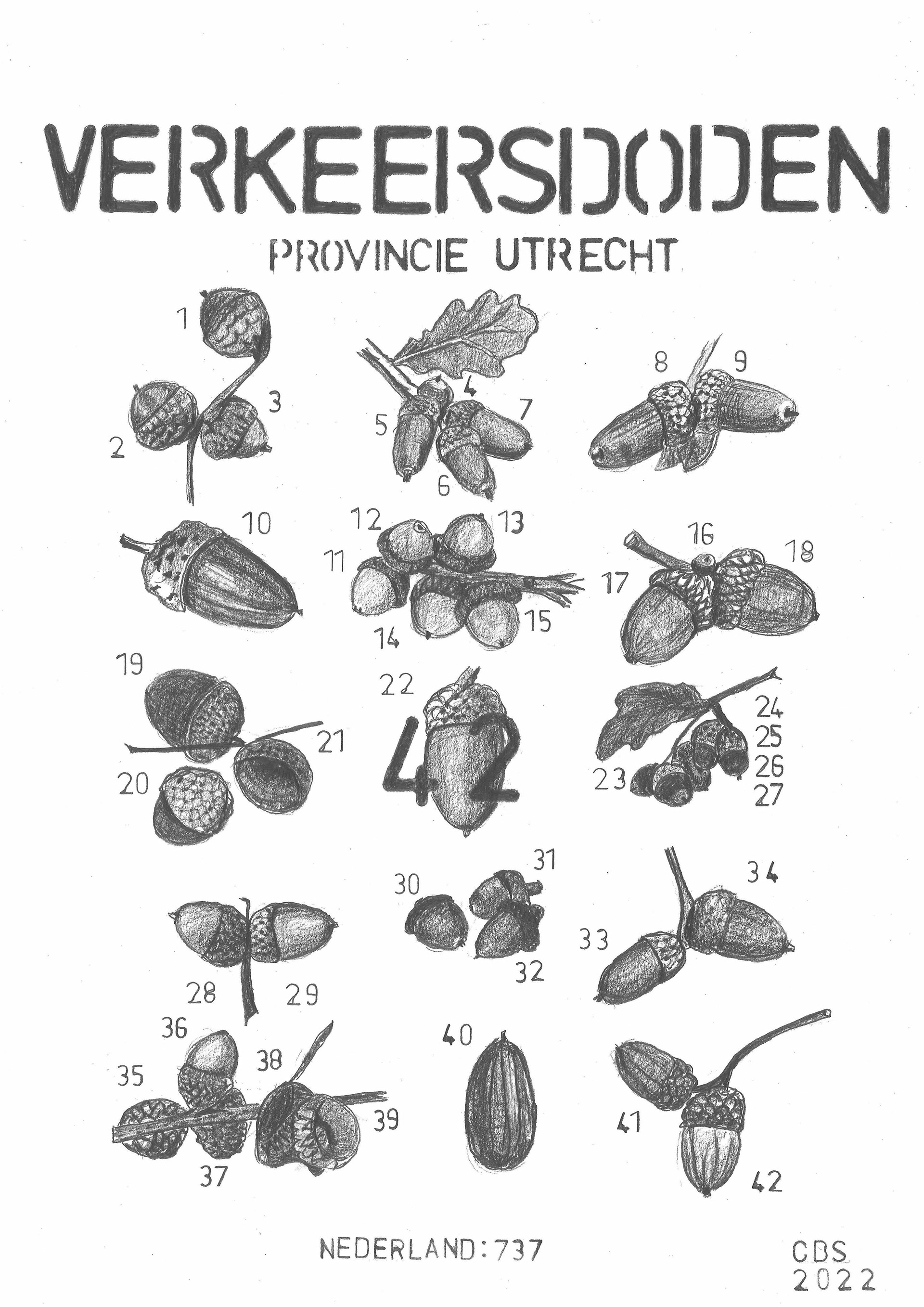
Traffic Fatalities: Research by Rijkswaterstaat indicates that a wider highway increases traffic safety. However, this comes at the expense of the iconic pedunculate oaks, which would need to be felled for the expansion of the highway.

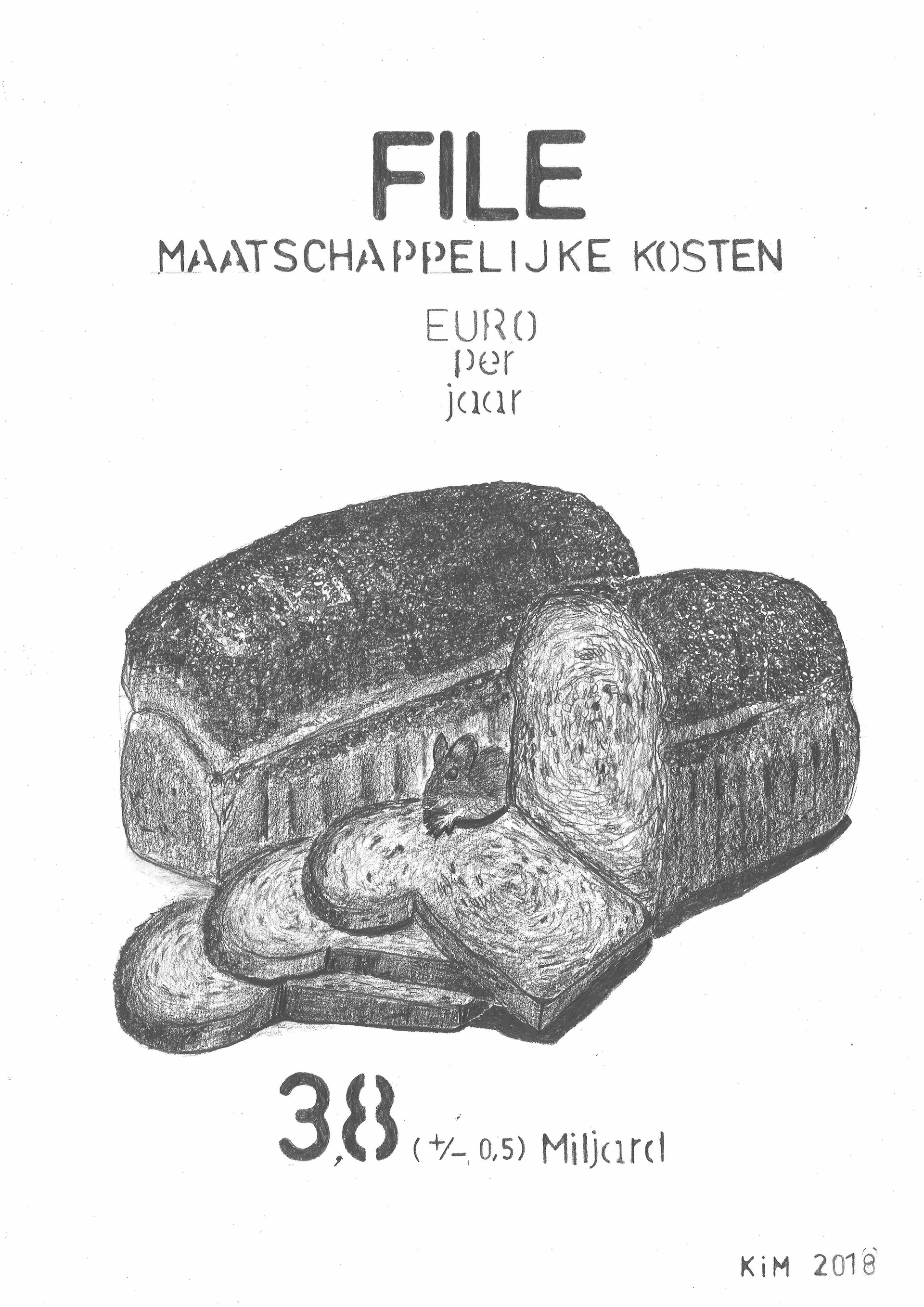
Het moet wel blijven rijden
It Has to Keep Moving
An interview with the trade association Transport and Logistics Netherlands revealed unexpected similarities between truck drivers and 'klimaatklevers' (climate activists who glue themselves to the asphalt). Both groups support encouraging more people to use public transportation to reduce CO₂ emissions due to efficient driving without traffic jams.
Traffic Jams: Traffic jams cost money and hinder economic growth. This argument, often framed as "bread on the table," is frequently used in politics to justify highway expansion.
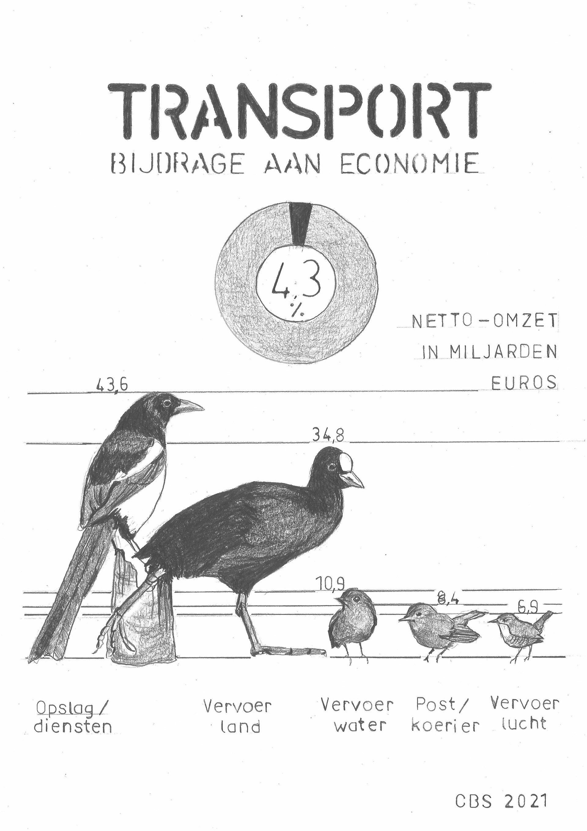
Transport’s Contribution to the Economy: Transport makes a significant contribution to the economy. This is visualized using birds of varying sizes, found in het forest next to the highway.
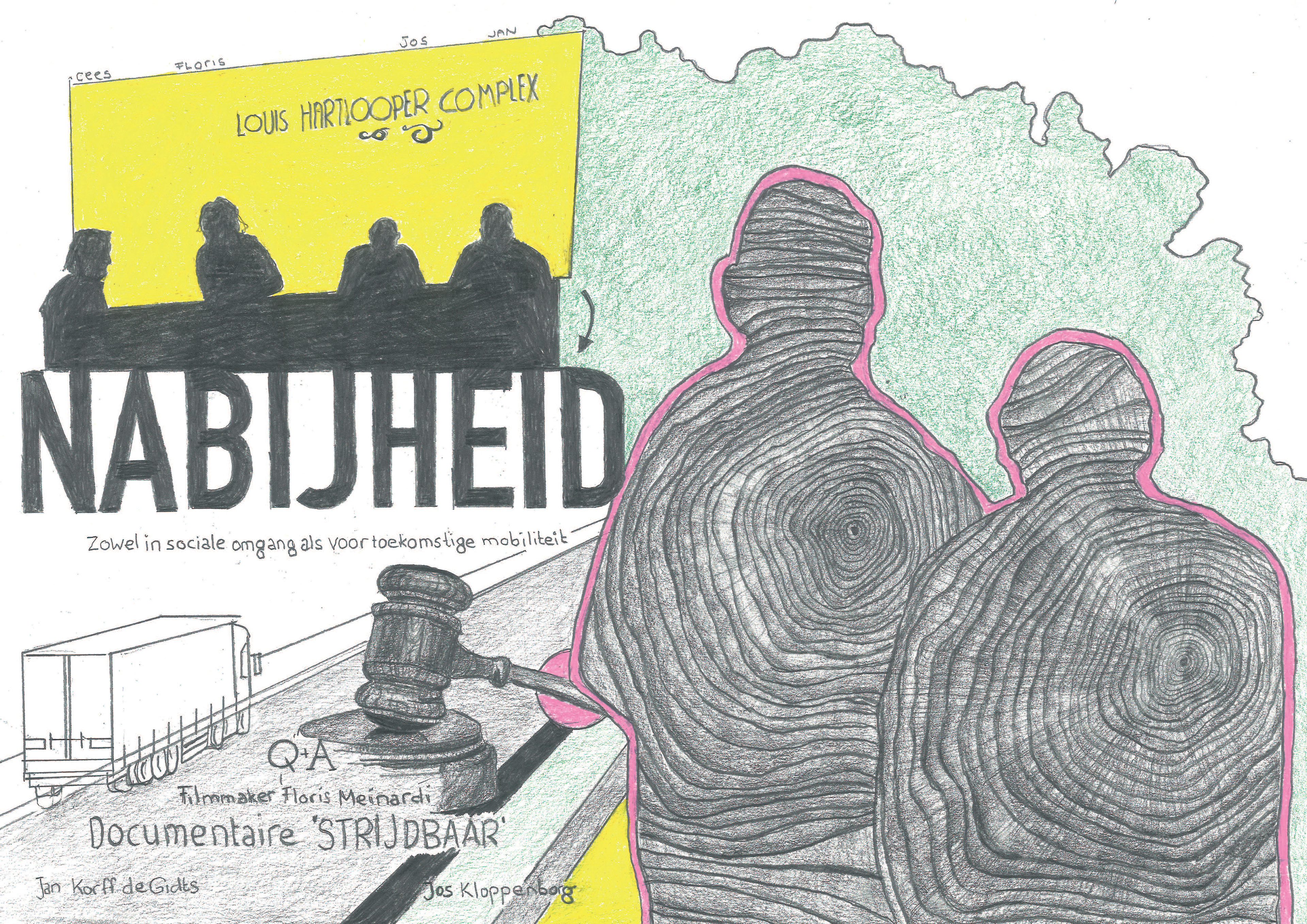
Nabijheid
Proximity
A documentary was made about two prominent figures who have fought to preserve the Amelisweerd forest from the beginning. They propose proximity as a solution: traveling less, buying local products, and consuming less could reduce the necessity of highway expansion.
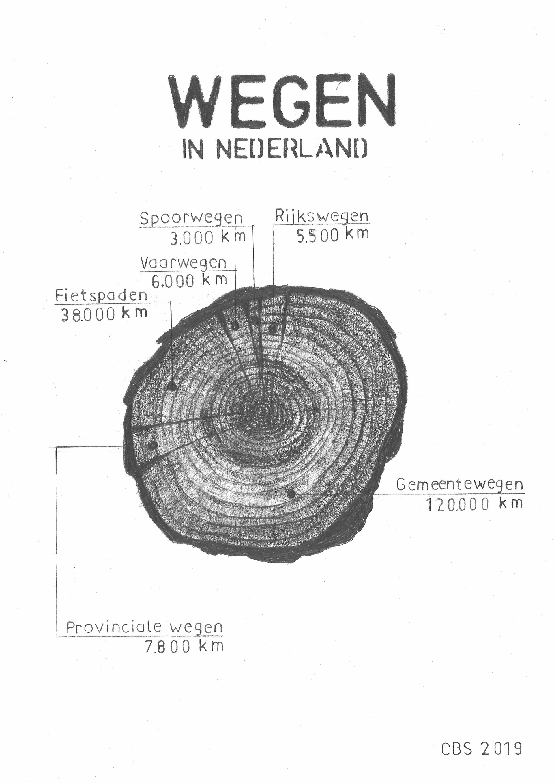
Roads in the Netherlands: This visualization illustrates the total kilometers of roads in the Netherlands. I guess the construction of new roads often requires the removal of trees.
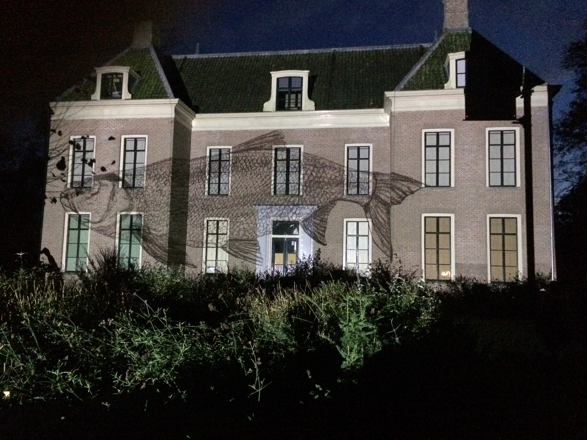
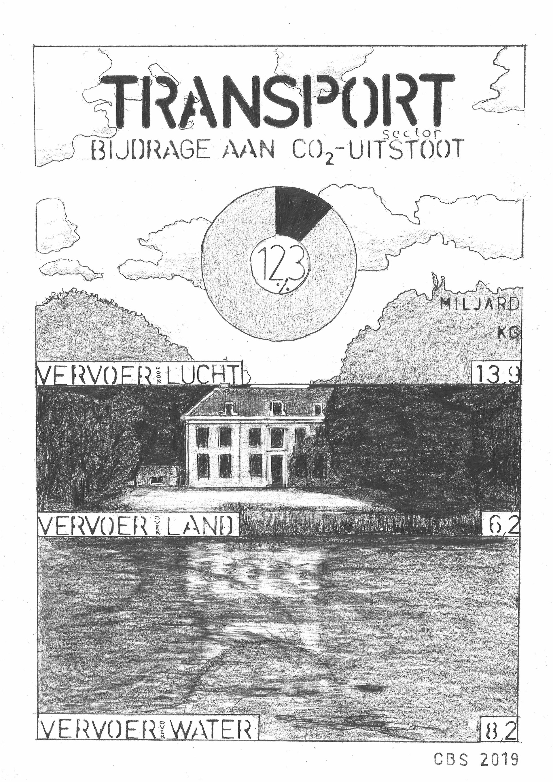
Transport’s Contribution to CO₂ Emissions: The transport sector significantly contributes to CO₂ emissions. The data visualization distinguishes between transport by land, water, and air. The image features the Oud Amelisweerd estate.